


Mo'orea
The Island of the yellow lizard
About the Island Mo'orea
Mo‘orea is located about 17 kilometers northwest of Tahiti, separated by the ʻŌpūnohu Channel. It is part of the Society Islands in French Polynesia, formed by volcanic activity approximately 1.5 to 2 million years ago. The island covers 134 square kilometers and is home to around 18,000 residents, primarily concentrated along the coastal roads.
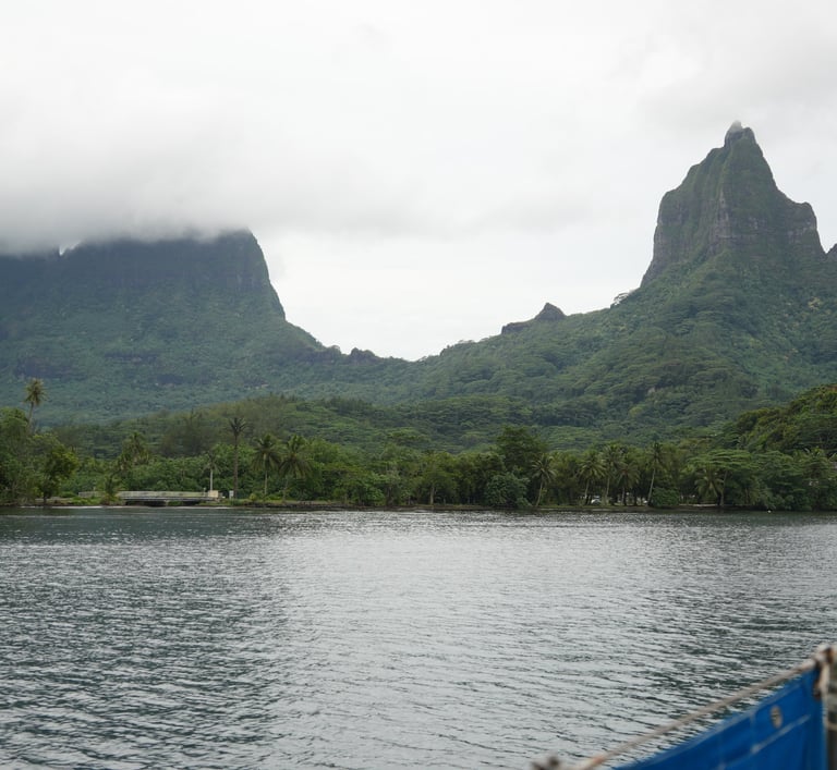
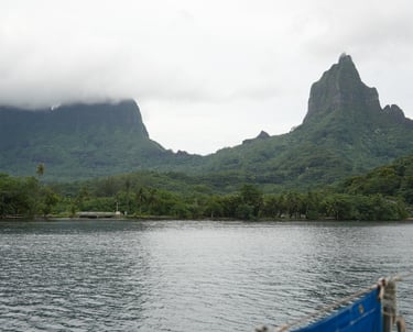
The island’s geography is shaped by its volcanic origin: a central caldera has eroded over time into a rugged landscape of peaks and deep valleys. Eight primary mountains form the island’s backbone, arranged roughly around the caldera remnant.
Main Mountain Peaks
Mount Tohiea – 1,207 m (the highest point, near the island center)
Tohi‘e‘a – ~960 m (not always separately listed; sometimes a variant spelling of Mount Tohiea)
Mount Rotui – 899 m (between Cook’s Bay and Ōpūnohu Bay)
Mou‘a Roa – 880 m (inland, southwest quadrant)
Mou‘a Puta – 830 m (south of Paopao)
Putoa – 850 m
Tearai – 780 m
Fareaitu – 740 m (inland near the southern coastline)
Rather than towering individually, these peaks are connected by ridges and valleys, forming steep terrain throughout much of the interior. Access to the central parts of the island is limited and typically via footpaths or ridgelines.
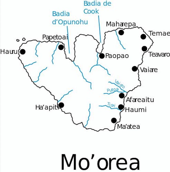
Mo‘orea’s beaches are primarily found along the northern and northwestern coasts, where the lagoon is widest and the reef offers calm conditions.
The main beaches are:
Temae Beach (northeast) – A long white sand beach near the airport and ferry port, popular for swimming and snorkeling.
Ta‘ahiamanu Beach (between the two main bays) – Public access with good reef proximity.
Papetoai and Hauru Beach area (northwest coast) – A stretch of sandy coastline with gentle lagoon access.
Southern beaches are narrower, and the lagoon is often shallower or closer to shore.
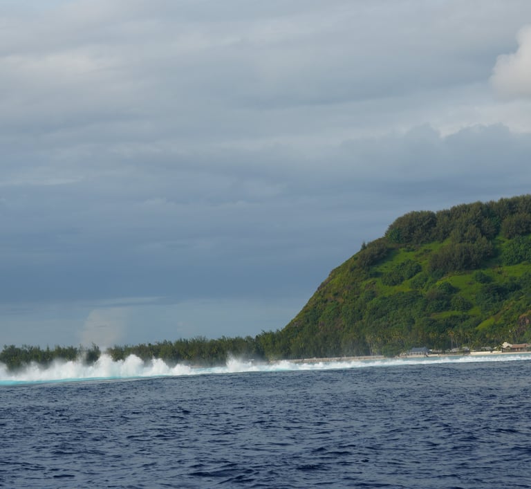
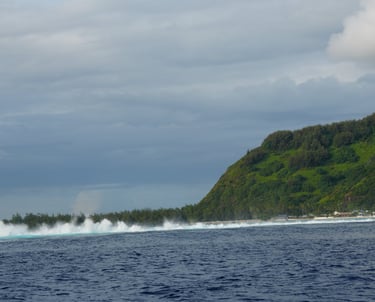
Mo‘orea is fringed by a nearly continuous barrier reef, enclosing a shallow lagoon that ranges from a few hundred meters to over a kilometer in width. The lagoon is accessible through 12 natural passes, which are gaps in the reef where freshwater outflows or ancient river valleys have prevented coral growth.
Notable reef passes include:
Passe ‘Āfareaitu (southeast)
Passe Tareu (Ōpūnohu Bay area)
Passe Ava’e (Cook’s Bay)
Passe Nuurua (west coast)
Passe Temae (near the ferry dock on the northeast coast)
These passes are important for marine circulation, fishing, and boat access. The reef provides protection from ocean swells and supports diverse coral and fish communities.
Conditions
Mo‘orea, like the rest of French Polynesia, has a tropical maritime climate characterized by warm temperatures, moderate humidity, and consistent trade winds. The island’s climate and oceanic conditions are largely influenced by its position in the South Pacific, just south of the equator.
General Weather Patterns
Seasons:
Wet season: November to April - Warmer, more humid, with occasional heavy rain and thunderstorms. Temperatures average 26–30 °C (79–86 °F).
Dry season: May to October - Cooler, drier, and more stable. Temperatures average 24–28 °C (75–82 °F).
Rainfall is more common in the interior mountains and north-facing slopes due to orographic lift (air rising over mountains).
Winds
Dry season - The island is primarily affected by the southeast trade winds (known locally as Te Moana Rahi), blowing steadily from the east-southeast at around 10 to 20 knots.
Wet season - The wind direction can become more variable, and occasional squalls or convergence zones can bring gusty conditions.
Waves and Swell
Ocean swells come mainly from the south and southeast, generated by distant storms in the Southern Ocean.
The north coast, where Cook’s and Ōpūnohu Bays are located, is sheltered from the dominant swell directions, making the lagoon calmer there.
During the austral summer (November–March), occasional north swells may enter the lagoon through the reef passes, causing short-lived wave activity inside otherwise protected areas.
Lagoon Conditions
The lagoon between the reef and shore is usually calm due to the barrier reef, with only small wind-driven chop under typical trade wind conditions.
Waves inside the lagoon are minimal except during periods of strong wind or swell entering through passes.
Ocean Currents
Nearshore currents are generally weak but can be influenced locally by:
Tidal exchange through the reef passes (twice daily)
Wind-driven surface drift, particularly on the south and east coasts
Freshwater outflows from mountain streams, which can create localized outflow currents at river mouths
The South Equatorial Current, a broad westward-flowing ocean current, passes north of the island group but doesn't strongly impact Mo‘orea’s lagoon or nearshore waters.
Moorings
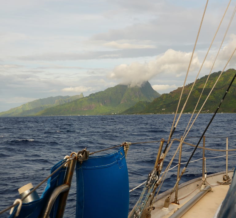
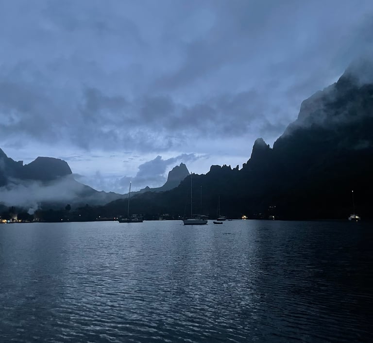
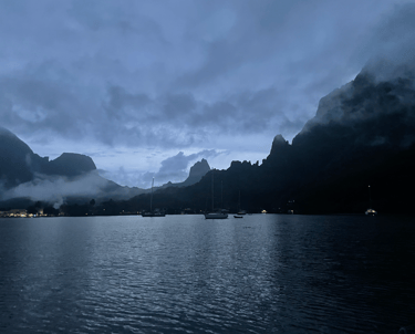
Moorea’s north coast is defined by two prominent, fjord-like bays, Cook’s Bay and Opunohu Bay, carved into the base of towering volcanic ridges and draped in dense vegetation. These bays represent ideal natural harbors, sheltered within the island’s protective fringing reef system. The dramatic topography not only offers breathtaking scenery but also influences local wind behavior and anchoring conditions.
Anchorage in Cook’s Bay, Moorea
The eastern bay, Cook’s Bay, is more developed and lies within the inner lagoon. Entry into the lagoon is facilitated by a 170-meter-wide reef pass, clearly marked with red and green lateral buoys and leading lights. This well-defined approach makes it accessible even to larger vessels under daylight and fair-weather conditions.
Water depths in Cook’s Bay range from 20 to 30 meters, and the protected shape of the bay allows anchoring well into its interior. The bathymetry, combined with good mud holding, offers secure anchoring for a variety of vessels.
Depth: ~20 meters
Bottom: Mud
Holding: Very good
Shore services are limited but functional. Fuel is available directly at the dock from a Mobile gas station. A small convenience store is located across the road, offering basic groceries. For a broader selection, another store is located roughly 300 meters north along the main road and offers fresh produce and essential items. The town of Maharepa, approximately 2–3 miles east along the coastal road, provides access to banks, ATMs, a post office, and more comprehensive provisioning.
Anchorage in Opunohu Bay (Western Bay)
Opunohu bay is the west one. The pass through the reef is well marked by red/green buoys and leading lights, and is 200m wide. This anchorage is located on W part of the bay’s head, near the Papetoai village. Turn slowly right (West), follow the green / red marks then follow north of white / black mark. When you pass the last turn slowly right and sail over the shallow sandy area (watch the corlas).
Depth: ~4 meters
Bottom: Mud
Holding: Very good
To Do's
Hikes
Three Coconuts Pass (Col des Trois Cocotiers)
Start: From Belvédère Lookout
Level: Moderate
Time: 2–3 hours round trip
Highlights: Jungle path, panoramic views over Opunohu and Cook’s Bay
Magic Mountain
Start: Near Papetoai, can hike from the base road or partway up via 4x4
Level: Easy to Moderate (steep but short)
Time: 30–60 minutes round trip
Highlights: Stunning views over the lagoon and motus of northwest Moorea
Three Pines Pass (Col des Trois Pins)
Start: From Belvédère Lookout
Level: Moderate
Time: 2–3 hours round trip
Highlights: Forested trail with fewer tourists, connects with other trails like Three Coconuts
Afareaitu Waterfall Trail
Start: Near Afareaitu village, southeast coast
Level: Easy to Moderate
Time: 1–1.5 hours round trip
Highlights: Tropical vegetation, river crossings, small but scenic waterfall
Mount Rotui (Between Opunohu and Cook’s Bay)
Start: Trailhead often begins from Pihaena
Level: Very Difficult – for experienced hikers only
Time: 5–7 hours round trip
Highlights: Knife-edge ridges, dramatic views over both bays, not recommended in wet conditions
Mount Tohivea (Moorea’s highest point)
Start: Trail from Paopao Valley or via 4WD road
Level: Very Difficult (long, technical)
Time: 6–8 hours round trip
Highlights: Highest summit, panoramic views of the island and Tahiti, best with a local guide or GPX file
Bike ride
Full Island Loop (Coastal Ride)
Distance: ~62 km (38.5 miles)
Start/End: Anywhere on the island – it's a loop!
Level: Moderate (flat with occasional hills)
Time: 3–5 hours depending on pace
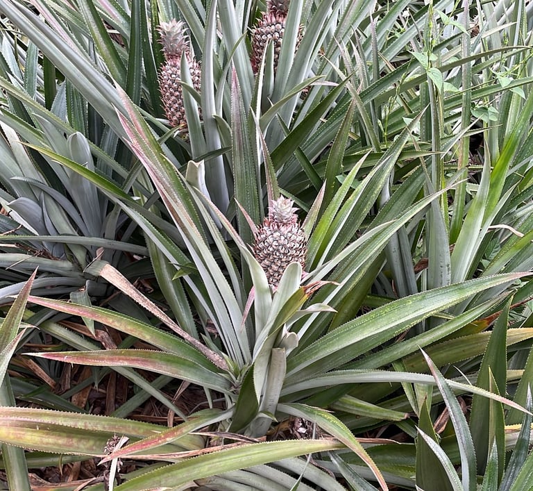
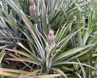
Highlights: Beaches, bays, villages, food trucks, pineapple fields
Tip: Go clockwise to stay closer to the ocean and have easier shoulder views
Opunohu Valley Ride
Distance: ~10–15 km round trip
Start: From the main coastal road at Opunohu Bay
Level: Easy to Moderate
Time: 1–2 hours
Highlights: Quiet road through pineapple plantations, marae (temples), and lush vegetation
Optional: Extend to Belvédère Lookout (steep climb)
Temae to Maharepa Village
Distance: ~7 km (one way)
Level: Easy
Time: ~30–45 min one way
Highlights: Coastal road, Sofitel area beaches, local shops and cafés in Maharepa
Culture and Historic Sides
Marae Titiroa
Location: Opunohu Valley, accessible via the Belvédère Lookout trail.
Best Time to Visit: Morning or late afternoon to avoid midday heat.
Entry Fee: Free.
Highlights: An ancient stone temple with a sacrificial rock plateau at the rear. Historically, only men were permitted inside.
Temple de Papetoai
Location: Papetoai village, northwest coast.
Best Time to Visit: Daytime hours; check for any scheduled services.
Entry Fee: Free.
Highlights: An octagonal Protestant church built in 1833 by missionaries, rich in history and legends.
Sentier des Ancêtres (Ancestors' Trail)
Location: Begins near the Belvédère Lookout.
Best Time to Visit: Morning for cooler temperatures.
Entry Fee: Free.
Highlights: A trail through lush forests leading to several restored marae, offering insights into ancient Polynesian society.
Rotui Juice Factory
Location: Between Cook's Bay and Opunohu Bay.
Best Time to Visit: Weekdays during business hours.
Entry Fee: Free.
Highlights: Sample a variety of local fruit juices and rums; tours may be available depending on the season.
Moorea Tropical Garden
Location: Overlooking Opunohu Bay.
Best Time to Visit: Morning to enjoy the garden in cooler temperatures.
Entry Fee: Approximately 200 XPF (~$2 USD), which includes parking and jam tastings.
Highlights: Explore a variety of tropical plants and enjoy homemade jams and panoramic views.
Snorkeling
Shark & Ray Sandbar (Near Motu Fareone & Motu Tiahura)
📍 Location: Lagoon between Motu Fareone and Motu Tiahura, northwest coast of Moorea (Haapiti area)
✨ Highlights: Shallow sandy-bottom lagoon, frequent blacktip reef sharks, stingrays, and tropical fish
⚓ Anchoring:
Use sandy patches only (never anchor on coral!)
Depth is about 1.5–2 m — perfect for dinghies
No public mooring buoys, but good holding in sand
🌬️ Tips: Go early morning for best visibility and fewer tour boats
Coral Garden (Just west of Motu Tiahura)
📍 Location: Western side of Motu Tiahura (right outside the Intercontinental Moorea closed resort)
✨ Highlights: Vibrant coral reef, schools of butterflyfish, parrotfish, triggerfish
⚓ Anchoring:
Look for clear sandy spots just before the reef drop-off
Shallow entry, best done at mid to high tide
🛑 Watch Out: Moderate current; stay close to your entry/exit point
Temae Reef
📍 Location: Along Temae Beach, northeast Moorea near the Sofitel
✨ Highlights: Long coral shelf with good visibility, sea cucumbers, clownfish
⚓ Anchoring:
Anchor dinghy in outer sandy pockets inside the fringing reef
The reef is shallow and close to shore — paddle in carefully
🚫 Tip: Avoid during strong easterly winds or swell
Ta’ahiamanu Public Beach Reef (Opunohu Bay exit)
📍 Location: North of Opunohu Bay at Ta’ahiamanu Beach
✨ Highlights: Easily accessible reef slope, wrasses, coral heads, usually calm conditions
⚓ Anchoring:
Good sand patches near reef edge
Or anchor farther out and snorkel in with fins
🚗 Alternate: You can also beach your dinghy and swim out
Legend
The following is the most cited legend even so there exist a lot of different variations.
In ancient times, a couple named Temaiatea and his wife lived on the island of Maiao (formerly Tupuai-Manu). The wife gave birth to an egg, which they placed in a cave named Vaionini. One night, she dreamed of giving birth to a yellow-skinned boy. Upon checking the egg the next morning, they discovered it had hatched into a yellow lizard. They named him Moʻorea, combining moʻo (lizard) and rea (yellow) in Tahitian.
As Moʻorea grew, he became enormous, causing the couple concern. Fearing for their safety, they decided to abandon him. Temaiatea built a canoe, and they fled towards Tahiti. Realizing he had been left behind, Moʻorea plunged into the sea in search of his parents. He battled three formidable currents:
Teara-Veri: Sinuous like a centipede.
Tefara: Thorny like the pandanus plant.
Tepua: Foamy like soap
Exhausted, he drowned, and his body washed ashore on Aimeho (the former name of Moʻorea). Two fishermen found the giant lizard and exclaimed, "E moʻo reʻa!" ("It's a yellow lizard!"). From that day, the island was named Moʻorea.
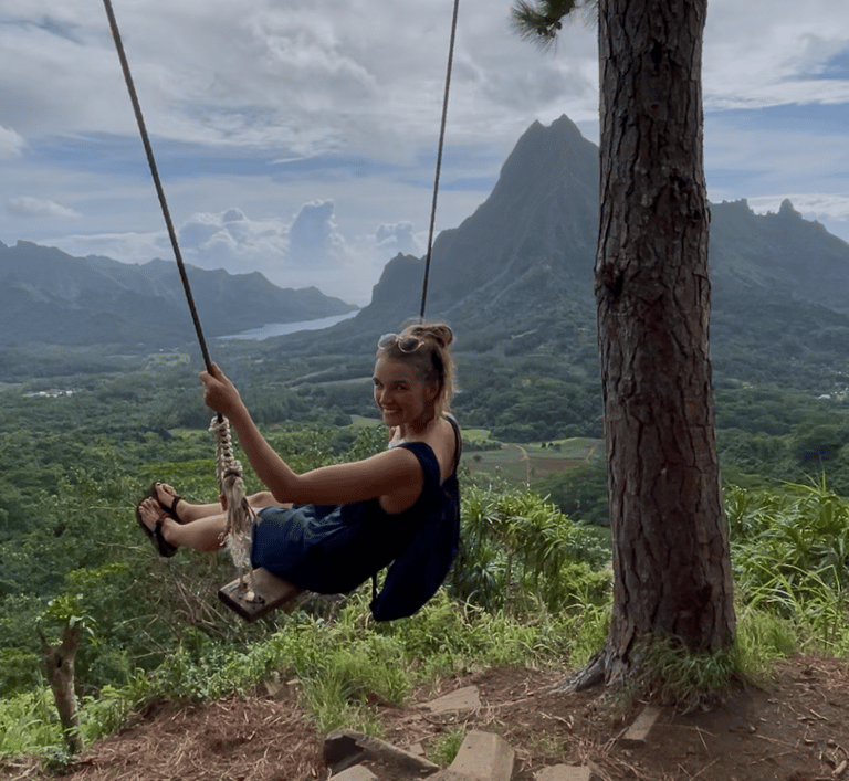
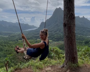
Our Experiences
In early June, we spent two days in Opunohu Bay and three days in Cook’s Bay. The island is stunning, with lush landscapes and fantastic hiking opportunities. Our favorite hike was the trail up to the Three Pines and across Coconut Pass. From the top, we had an incredible view over both bays, and along the Coconut Pass trail, we also passed several ancient temples.
It was magical to walk through the dense forest and see the pineapple fields stretching across the valleys. Opunohu Bay was quieter and had fewer boats anchored, while Cook’s Bay made it easier to get ashore for groceries and errands.
Because the bays lie on the windward side of the island, they catch a lot of moisture from the trade winds, making the air humid and bringing frequent, heavy rain, but that’s also what makes the island so vibrantly green. Twice, we were lucky enough to see large groups of dolphins swimming around the boat.
It’s truly a special place to be. Read about our experiences in our blog articles here and here.
If you’d like to read more, follow our journey, and support what we do, don’t forget to subscribe to our newsletter or follow us on social media. Every bit of encouragement helps keep the adventure going and we’d love to have you aboard!